
Reunion microclimates
One island, many atmospheres: step straight into Réunion reality
On Réunion, changing neighborhood, gaining a few hundred meters of elevation or switching from one slope to the other is often enough to change worlds. You go from dry heat to tropical humidity, from a perfectly clear sky to stubborn mist, from a short, heavy downpour to a whole day of fine rain. This patchwork is not just a feeling: it structures vegetation, agriculture, architecture, outdoor activities, and even eating habits. Understanding microclimates is therefore reading the island like a living map, where the relief, the trade winds and the ocean are in constant dialogue.
The engines of microclimates: relief, trade winds, altitude and sea
Relief as a cloud-making machine
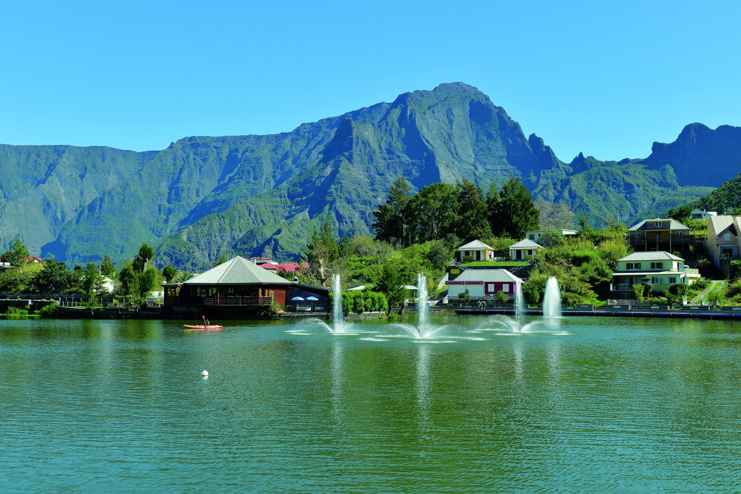
Réunion's relief is not a backdrop: it acts like a vast meteorological device. When moist air from the ocean meets the slopes, it rises, cools and condenses its water vapor. The result: clouds and rain concentrate over certain areas, while others remain sheltered. This mechanism explains why two nearby municipalities can record very different rainfall totals, and why a hike can take place under bright sun… until the next pass.
Trade winds: the dominant flow that shapes contrasts
The trade winds most often blow from east to west. They carry marine moisture that clings to the relief. The windward sides (east and northeast) are generally wetter and greener; the leeward sides (west) more often enjoy drier, more stable weather. In practice, this contrast is reflected in landscapes, plant species and very distinct thermal atmospheres.
Altitude: a thermal elevator (and sometimes, a fog elevator)
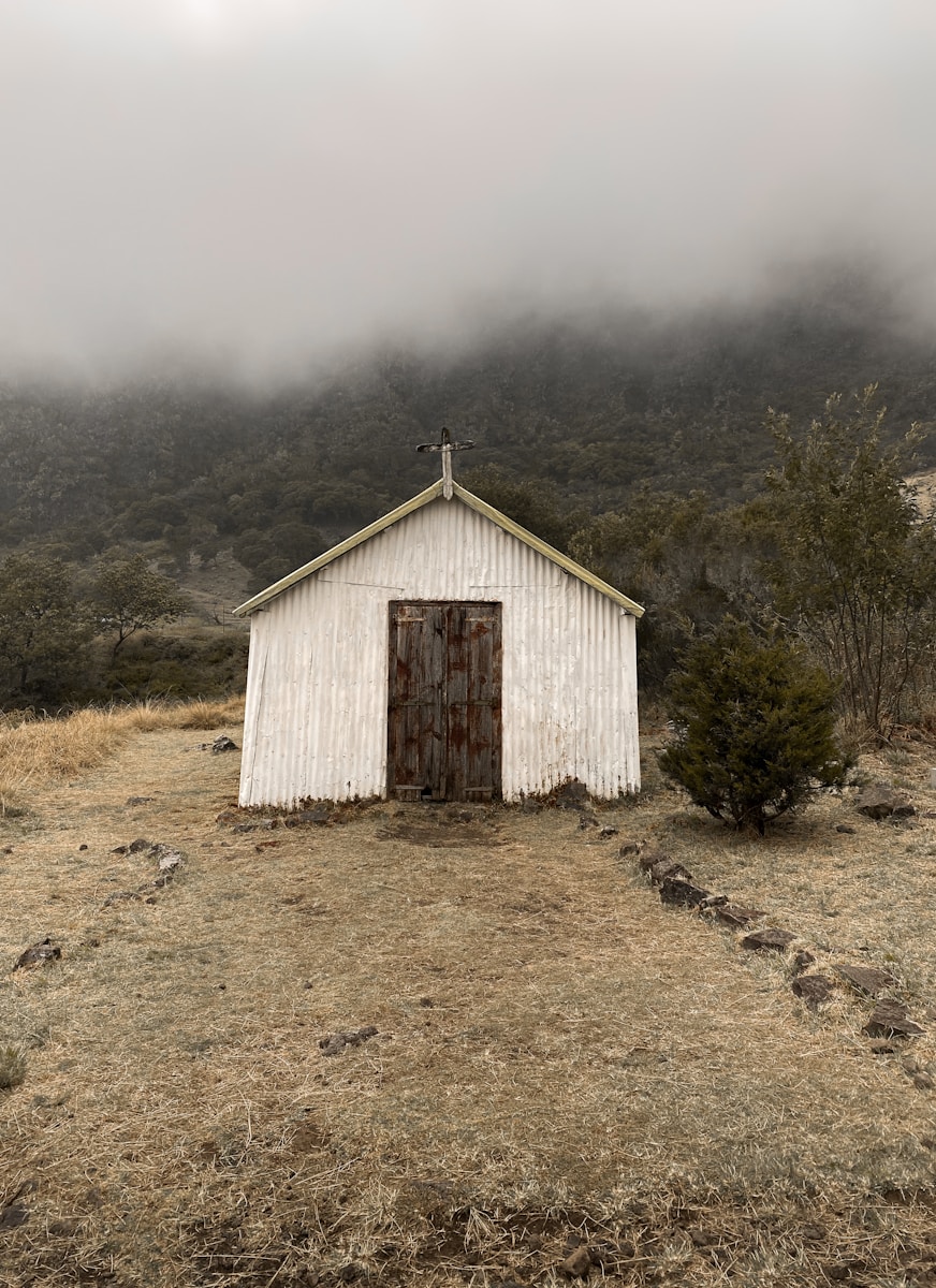
As you go up, temperature generally drops, and you pass through climatic zones. On the mid-slopes, one frequently encounters a cloudiness zone: low clouds, reduced visibility, persistent humidity. This ceiling is not fixed: it rises or falls depending on the season, the time of day, and wind strength. That explains bright mornings followed by cloudier afternoons in certain areas, notably when local breezes add to the trade wind regime.
The ocean: a reservoir of moisture and thermal regulator
The sea softens extremes: near the coast, temperature variations are often less pronounced than at altitude. But it also brings the moisture that feeds showers and clouds. Sea and land breezes modulate the weather at the local scale: they can push clouds inland during the day, then favor drier or more stable air in the evening, depending on the orientation of the coasts and the layout of the valleys.
The main categories of microclimates on the island
Windward: humidity, dense vegetation and more frequent rains
On the east coast, the combination of trade winds + relief favors orographic rainfall. This results in lusher forests, more active ravines, and often moister soils. Bright spells occur, sometimes very clear, but the likelihood of an unexpected shower is higher there. To deepen the general logic of the island's weather, a useful resource is Climate of La Réunion, which helps link seasons, prevailing winds and local nuances.
Our Vacation Rentals in Réunion
Leeward: drier, sunnier, but not uniform
The west coast is known to be drier, but dry does not mean the same everywhere. A well-exposed ravine can channel humid air; a differently oriented slope can catch clouds; an urbanized area can also create a micro heat island. In summer, convection can trigger localized showers even on the west, especially near reliefs, while the coastline remains under a more open sky.
The highlands: coolness, range and changeable weather
Above certain elevations, the air becomes cooler, sometimes cold at night, and conditions can change rapidly. The same route can go from sun to mist, then to dry wind. This variability strongly influences the choice of clothing, the start time of hikes, and the organization of sporting activities. Weather windows are valuable there: they require observing the sky, the wind, and the clouds clinging to the ridges.
Cirques and valleys: bowl effects, breezes and inversions
In cirques, nights can be cooler, and temperature inversions can trap cold air at the bottom, while higher slopes remain relatively milder. Slope breezes (upslope by day, downslope by night) shape very localized microclimates: a shaded ravine can stay damp for a long time, while a sun‑exposed escarpment becomes dry and warm in a few hours.
Seasons and local rhythms: when microclimates express themselves most
Warm, humid season: intense showers and heightened contrasts
During the austral summer, heat increases evaporation and the energy available for convective rainfall. Showers can be brief but torrential, sometimes concentrated over a few kilometers. It is a period when microclimates are very visible: one area can take heavy rain while another, very close by, stays dry. The relief amplifies these contrasts by anchoring cloud lines and locally intensifying precipitation.
Cooler season: trade winds, more stable weather… and surprises at altitude
In the austral winter, the weather is often more stable, particularly in the west. But the trade winds can bring chill to the ridges and increase the perceived windiness. Cloud layers can form at mid‑slope, making some areas greyer and more humid, while the coast enjoys clear skies. It is also a period when longer outings can be planned more easily, provided local particularities are respected (mist, wind, nocturnal temperature drops).
Microclimates and biodiversity: the forest as an indicator
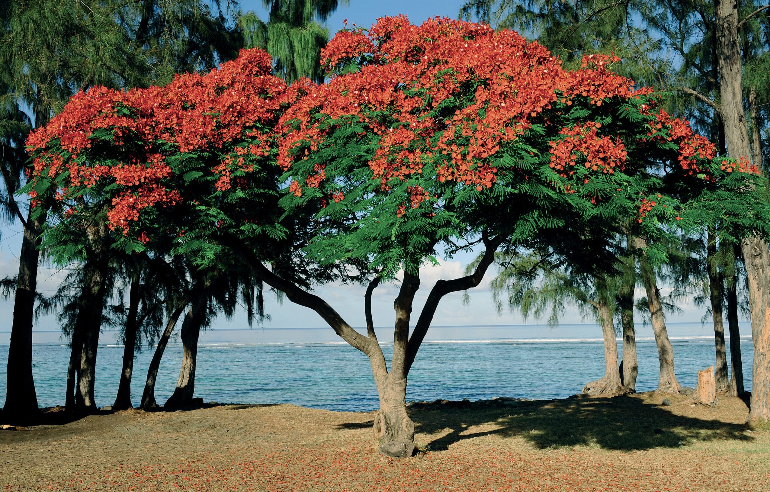
On Réunion, vegetation reads the climate better than any signboard. The transition between dry formations, humid forests, high‑altitude heathlands or more open environments directly reflects the distribution of rainfall, temperatures and atmospheric humidity. Microclimates create refuges and ecological niches, sometimes over very short distances, which contributes to the island’s biological richness.
To connect these issues to the dynamics of forest environments, the page Climate and our forests in La Réunion provides useful insight into the links between climatic conditions and forests, as well as how these environments adapt to local constraints.
Agriculture: why the same island produces such different crops
Microclimates are more than just a weather topic: they determine what grows, where and how. Sunshine, wind, rainfall frequency, nighttime humidity, average temperature and temperature range change the game for crops. Some areas favor sugarcane, others fruit trees, and others still cooler highland productions. Planting schedules, disease pressure, irrigation needs and yields vary accordingly.
Sugarcane: a crop shaped by water and sun
Without getting into generalities, one simple idea can be retained: in wetter areas, water is less limiting but excesses (waterlogged soils, gullying, diseases) can complicate management. In drier areas, sunshine and stable weather are assets, but irrigation and resource management become central. This agricultural geography also has a history, intimately linked to landscapes and land planning. To place this crop in a long-term perspective, you can read an article on the origins and evolution of the sugar industry.
Coffee, vanilla and terroir crops: the art of putting a plant in the right place
Vanilla likes very particular conditions: heat, humidity, protection from direct wind and excess sun, while avoiding soil suffocation. Coffee, depending on varieties and management choices, often seeks a balance between warmth, cool nights and well-distributed rains, sometimes with shade. These subtleties explain why some terroirs are renowned: the microclimate is not a detail, it is the foundation. If you want to link these conditions to concrete visits, this article dedicated to plantings to discover will give you leads.
Our Vacation Rentals in Réunion
Living microclimates daily: housing, clothing, daily rhythm
Residents adapt to these variations: house orientation, natural ventilation, humidity management, choice of materials, protection from driving rain or the afternoon sun. In wetter areas, ventilation and condensation control are often prioritized; in hotter, drier areas, shade, air circulation and appropriate thermal inertia are sought. Even routines change: some activities are done early to avoid clouds and heat, others are planned according to the typical showers of an area.
Hiking, cycling, swimming: adapt your activities to the climatic mosaic
Read the sky and the terrain: a few simple reflexes
In Réunion, a forecast for the island is often too broad. Good practice is to cross-check weather information with altitude, exposure (windward/leeward), and time. A sky building up on the slopes can signal persistent mist at altitude while the coast remains clear. Conversely, heavy heat can favor localized showers inland even if the coast seems stable.
By bike: wind and slopes change everything
Microclimates strongly influence effort: headwinds, humidity that intensifies the feeling of heat, fine rain that cools on descents, fog reducing visibility. On some routes you can also move very quickly from dry air to a humid zone, which requires having a light waterproof layer even in good weather. To plan outings suited to local conditions, a selection of cycling routes can help choose according to elevation, exposure and landscapes.
Microclimates and cuisine: when the weather ends up on the plate
Without claiming that climate explains everything, it influences the available products and how they are enjoyed. In the cooler highland areas, one may seek more comforting dishes; on the warm coast, meals can be accompanied by lighter preparations at certain times of the day. Variations in crops (spices, herbs, fruits, vegetables) from different terroirs also contribute to the richness of Réunion cuisine.
From the market to the cari: diversity of products, diversity of microclimates
Part of the culinary magic comes from the variety of productions in a compact territory: what grows well in a humid area does not necessarily thrive in a drier zone, and vice versa. This complementarity feeds the markets and the tables. For an overview of the foundations and influences, this guide on Creole cuisine allows linking products, traditions and ways of cooking.
Choosing where to eat according to the place… and the weather
A very practical tip: the microclimate can guide the timing and location. After a wet hike in the highlands, a hot spicy dish is often welcome; after a dry sunny day on the west coast, one sometimes favors an airy dining room, a shaded terrace or a place near the sea. If you are looking for addresses and landmarks, this article to taste a traditional cari gives useful leads.
Observe and learn: a field approach to microclimates
The best way to understand microclimates is to observe them: note the times clouds arrive on a slope, compare the temperature between the coast and mid-slope at the same hour, watch how the wind turns in a valley, spot areas where vegetation changes abruptly. With a simple notebook (or an app), you can build your own mental map of the island. This knowledge becomes valuable for organizing vacations, choosing a hike, planning a beach outing, or deciding on a return route when rain sets in over an area.
For an educational approach focused on this topic, you can consult a presentation on microclimates linked to the Vincendo Climate Project, which illustrates well how these phenomena manifest locally.
Practical tips for traveling microclimate-friendly
First rule: allow for margins. On a mountainous island, a plan A and a plan B are often the key. If the east is under rain, the west may offer a pleasant window; if the highlands are in the clouds, the coast may remain clear. Second rule: pack light but smart. A compact waterproof windbreaker, a warm layer for altitude, sun protection, and something to protect your phone and documents from showers often suffice to transform the day. Third rule: accept variability as an asset. Microclimates are part of the Réunion experience: they reveal atmospheres, scents, light, and landscapes that change hour by hour.
Our Vacation Rentals in Réunion
Choose your base: be well placed to explore several atmospheres
As conditions vary greatly, the accommodation location plays a strategic role. Being within reach of several routes allows you to pivot to the most favorable area of the day: beach and west-side sunsets, forests and waterfalls in the wetter sectors when weather permits, rising early to enjoy a window on the highlands before the clouds arrive. If you want a practical starting point to radiate from, you can consult the availability of our accommodations.
What to remember: a legible island, once you learn its codes
Understanding microclimates in Réunion means learning a few simple rules: the effect of relief on clouds, the role of the trade winds, the influence of altitude, and the windward/leeward contrast. With these markers, the island becomes more predictable than it seems. You can better anticipate where to find sun, where to expect a shower, why vegetation changes so quickly, and how to plan your days to fully enjoy the landscapes, products, and experiences. This knowledge does not replace the day’s weather forecast, but it provides a framework: the one that turns capricious weather into a true understanding of the territory.
 Français
 Español
 Deutsch
 English